A significant update to the worldwide VHF tropospheric propagation forecast tool hosted at https://tropo.f5len.org/WW/ is now available.
What the tool does
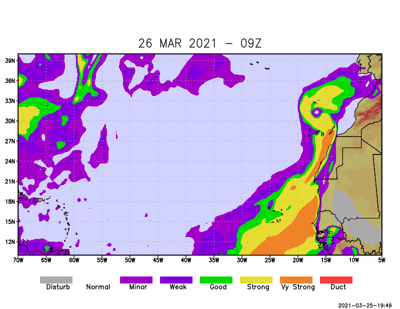
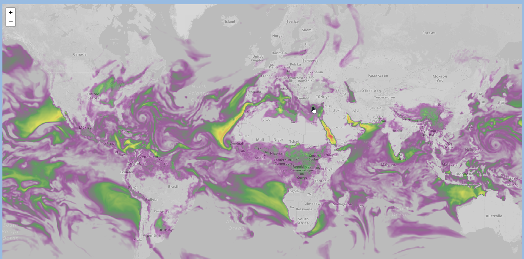
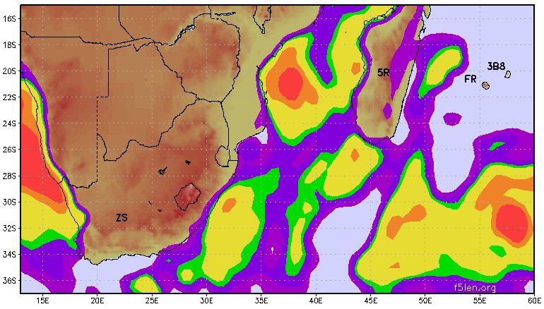
The tool provides worldwide forecasts and archives of tropospheric propagation conditions on the VHF bands, based on the calculation of the atmospheric refractive index (N-units). Data is updated four times daily and rendered as an overlay on an interactive OpenStreetMap / Leaflet map. Clicking anywhere on the map returns the local average refractive index value along with the Maidenhead grid locator.
What is new in this release
Step-by-step forecast navigation. Two ◀ / ▶ buttons now allow browsing through the forecast timeline directly, without opening the drop-down menu. The controls are synchronized with the selector and disable automatically at both ends of the forecast range (40 steps, covering approximately five days at 3-hour intervals).
Smart GeoTIFF preloading. Once a layer is displayed, the browser silently fetches the two adjacent forecast steps in the background (N+1 and N-1, then N+2 and N-2), with a controlled delay between each request to avoid saturating the connection. On subsequent navigation, those layers render instantly from the in-memory cache. On mobile or slow connections, preloading remains conservative and never interferes with an active user request.
Responsive layout. The map now fills the full available viewport height on any screen size, including mobile devices.
Various fixes. Layer removal is now handled via a direct object reference rather than an opacity-based search, eliminating a class of potential display artefacts.
Feedback
Comments and reports are welcome via the usual channels. The tool is intended for use by the amateur radio community for path planning on the 50 MHz, 144 MHz, and 432 MHz bands.
73 de F5LEN